
The Chattooga River begins in the Appalachian Mountains of
The Chattooga watershed is made up of 180,000 acres in three states (SC, GA and NC) and composed of private and public lands. The Chattooga is a free-flowing river with no upstream dam to control the flow. As such it responds rapidly to rainfall or drought conditions. There are numerous rapids up to Class V, followed by calm pools.
Since
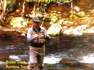
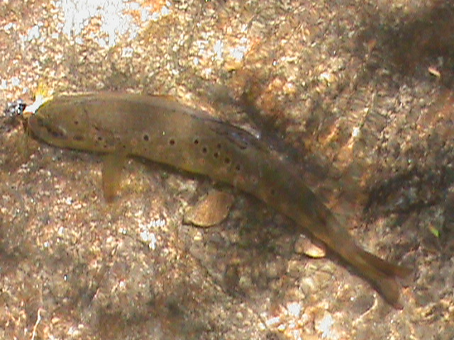
For wild trout fishing the best area is between the North Carolina State line and Burrells Ford. The entire river lies within the Chattahoochee, or the Sumter National Forest with the exception of a few tracks of private land downstream of the Highway 28 bridge.
The SCDNR state stocks the trout fingerling from Burrells Ford downstream for about five miles. Along this stretch of the river, there is plenty of food for the trout to eat and they can grow nicely. However, due to river conditions, there is very little spawning occuring here, as a result, do not expect to see many wild trout.
There is a delayed harvest designation on the Chattooga
Seasons:
The early season will provide the best fishing usually from April to June
Spring:
Spring is obviously the best season to fish the river due to its southern location.
Summer:
The water can get a little warm during the hot summer even though it often provides some shade.
Fall:
Autumn is an excellent time to fish the river as it is one of the most beautiful times of the year. In addition to that, it offers an excellent opportinity for catch and release fishing of brown trout, because they are spawning during this season.
Winter:
Due to the southern nature of the Chattooga River, the winter is one of the most productive seasons.
NOTE: If you have any suggestions to improve or to add to this information please use the Contact Form to do so.
You can access approximately 14 miles of the stream the stream from
Another way to access the Chattooga River is by paddling.
Maps:
Check out our full color, waterproof map and fly fishing guide measures 11" x 17"
Scroll down to view the Google Map
Trout University for free classes, Fly fishing Instructional DVDs and much more.
Recommended DVDs:
Fly Fishing Strategies That Catch Trout
More Resources: